Spatial Research Suite · Windows
Your remote-sensing lab, on your PC.
Pick the steps, press run and get a full report: land cover, change, trends, reefs and coastlines, all on your own Google Earth Engine, with no code. Free to analyse; subscribe to export.
The installer isn't code-signed yet, so SmartScreen asks you to confirm it (More info → Run anyway), and Windows may ask to let R through the firewall. Both are one-time. See the steps.
Inside the app
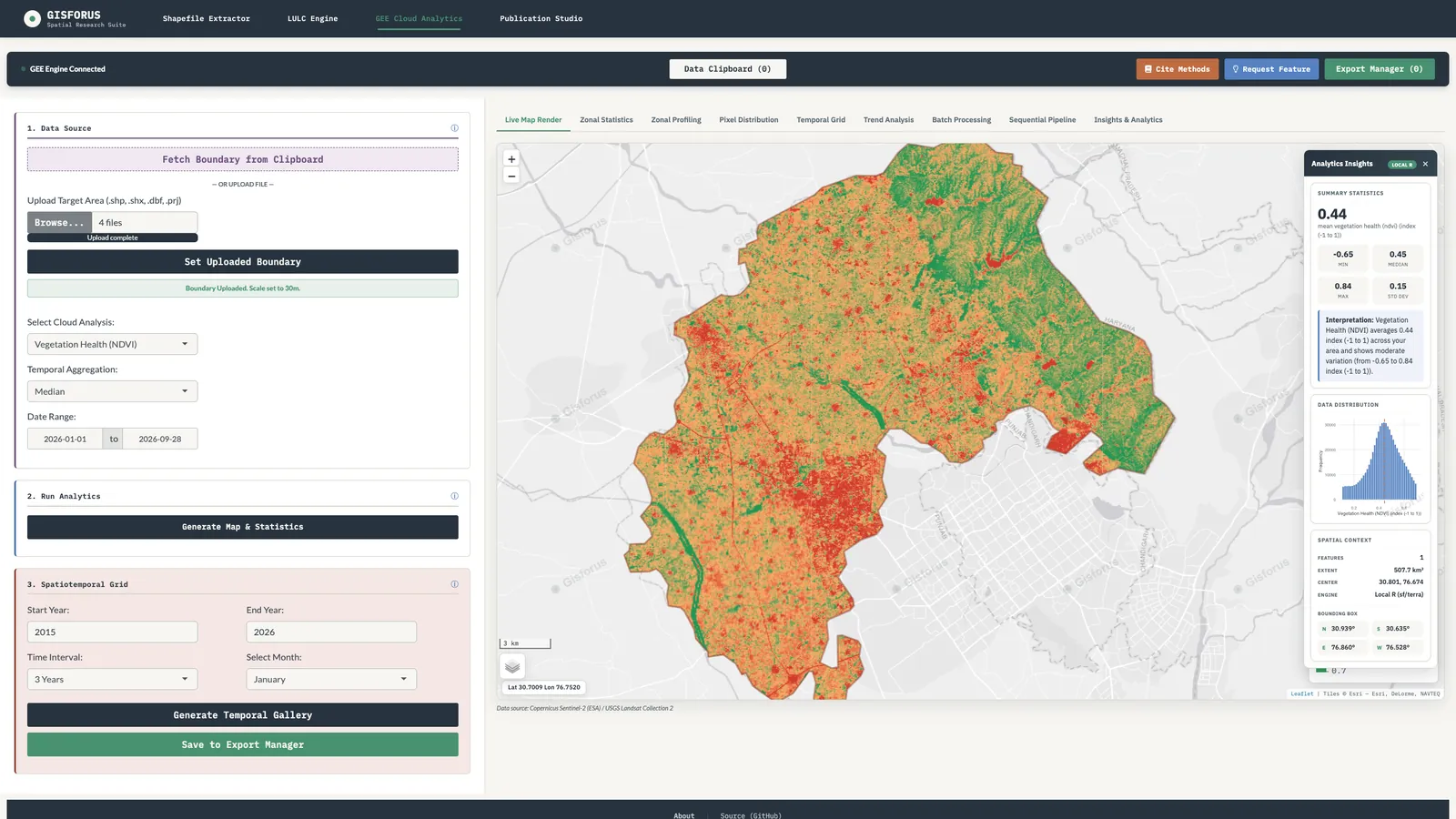
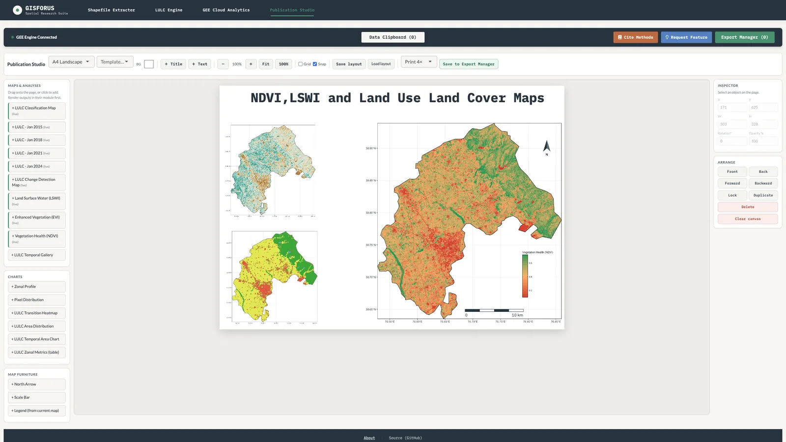
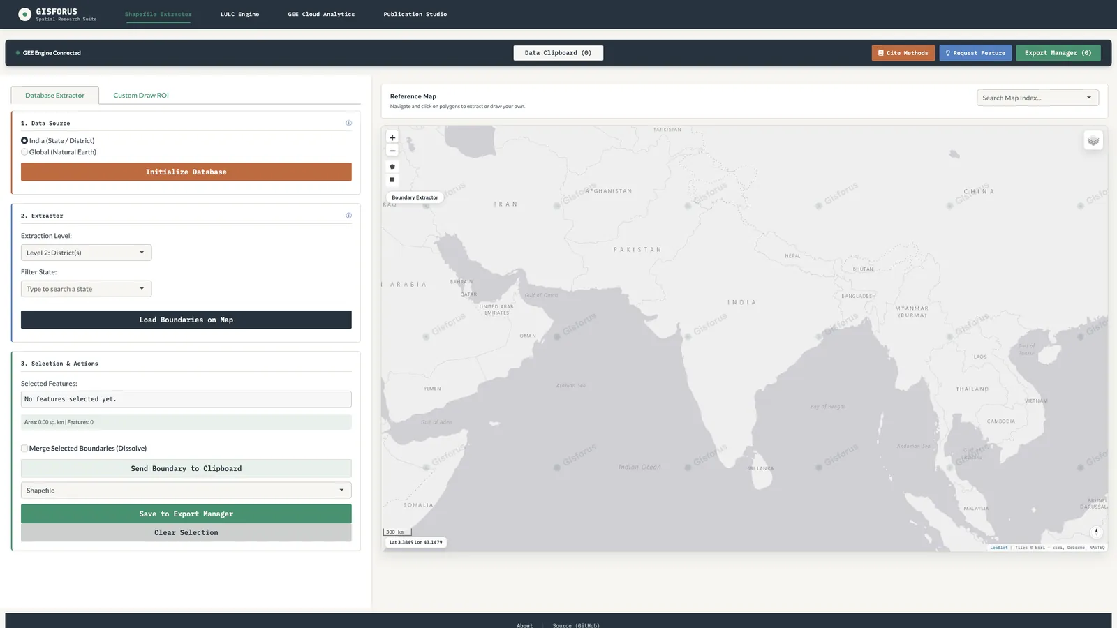
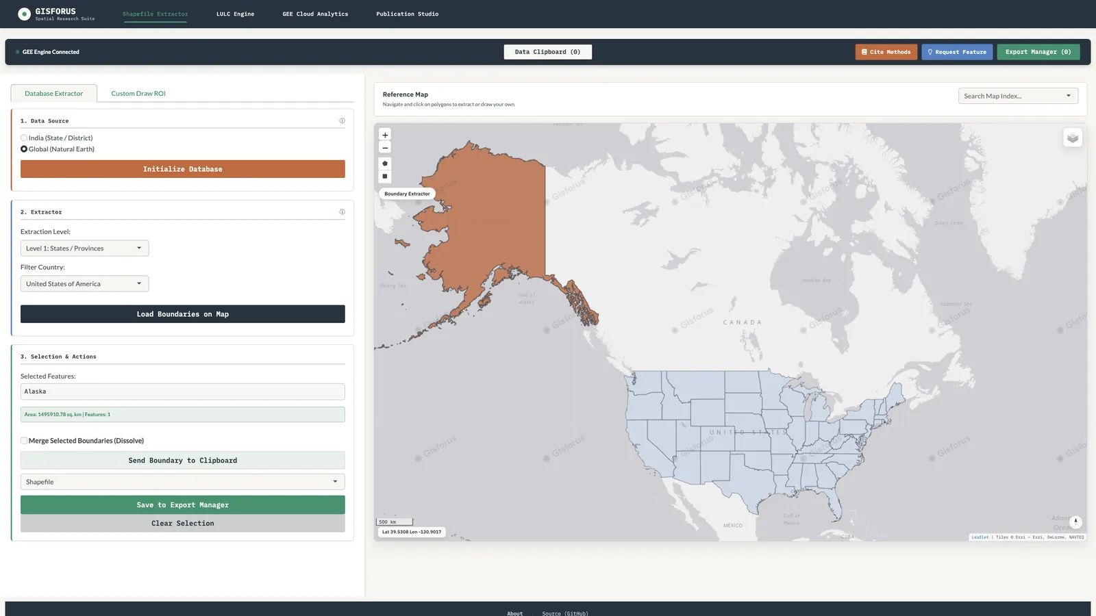
See it before you install it.
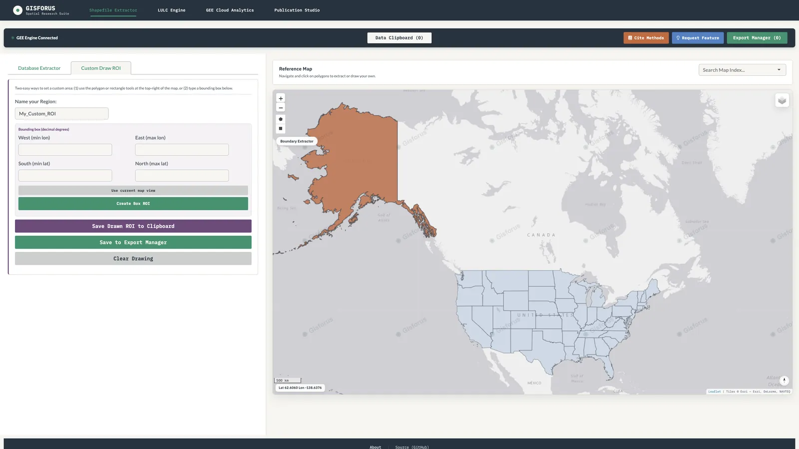
Real screens from version 1.1.1. Swipe, use the arrows or let it play.
First-time install · Windows 10 and 11
Five steps, once.
Two Windows prompts appear on the first run because the app isn't code-signed yet. After setup, it opens like any other program.
- Download and run the installer
Open
GISFORUS-Spatial-Suite-<version>-x64.exefrom Downloads and follow the installer. You can change the install folder. - Get past SmartScreen
If a blue “Windows protected your PC” screen appears, click More info, then Run anyway.
- Firewall prompt (optional)
On first launch Windows may ask to let R through the firewall. Allow is fine, but the app works even if you click Cancel, because it only talks to your own computer.
- Connect Earth Engine
Sign in to Google Earth Engine in your browser and enter your Earth Engine project ID (it looks like
ee-yourname). - Start working
The main window opens, and it opens normally every time after this.
Why the warnings?
The installer isn't code-signed yet, so SmartScreen asks you to confirm the first launch. That is expected for independent research software and doesn't mean anything is wrong. Download only from this page or our GitHub Releases, and check the file against the SHA-256 above. Code signing is planned.
What is the firewall prompt for?
The app runs its analysis engine (R) as a small server that listens only on 127.0.0.1, your own computer. Other devices on your network cannot reach it. Windows asks before any program listens for connections, even local ones, so you can click Allow or Cancel; the app works either way.
What's inside
Six modules, one study area.
Each module passes its boundary and mask to the next, so a study moves from extraction to a finished figure without re-exporting anything.
Sequential Pipeline
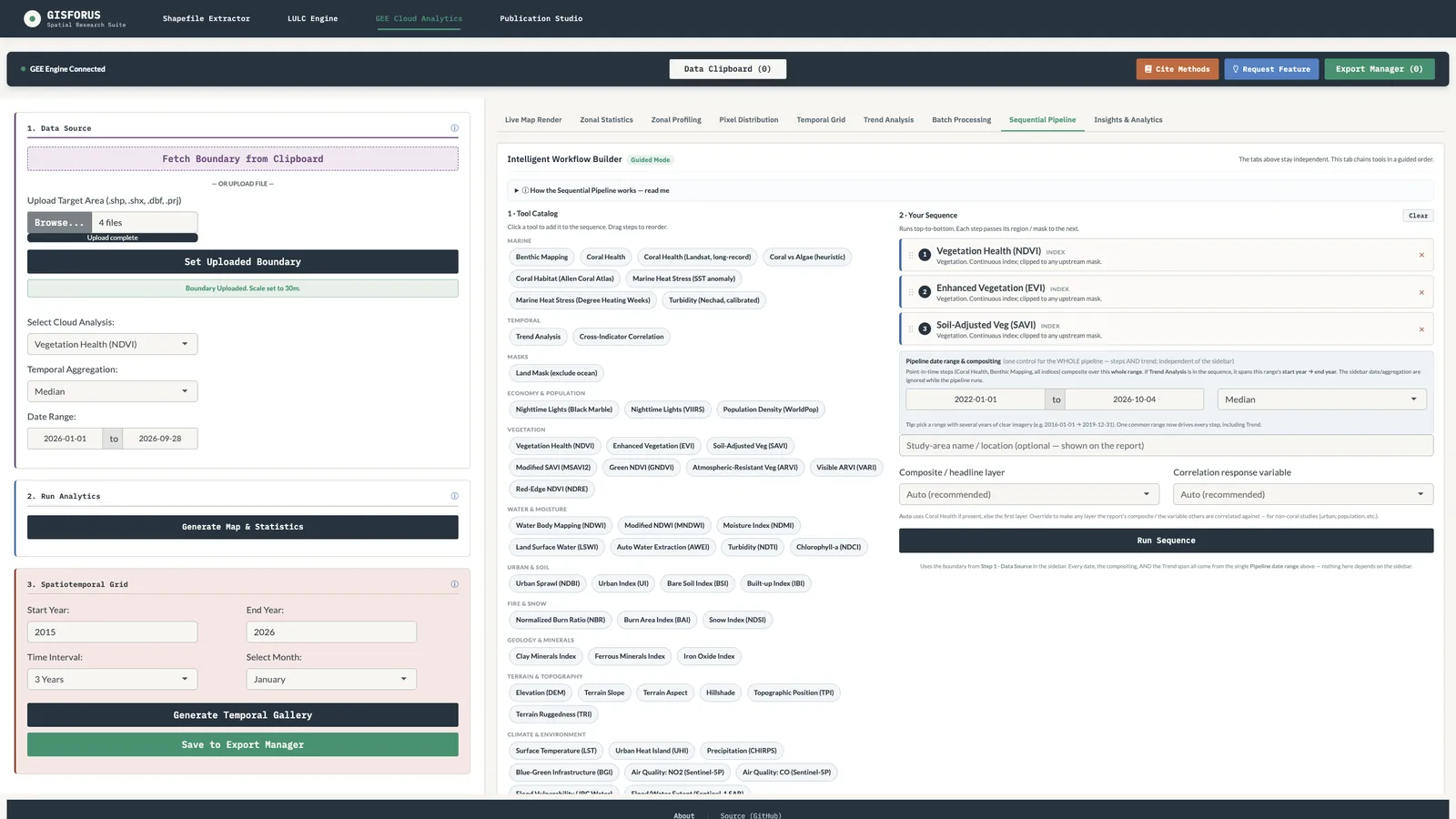
Click tools from a catalog of 60+ steps, drag them into order and press run. Masks, indices, coral and trend steps hand their region to the next, with one date range for the whole chain.
A report for every run
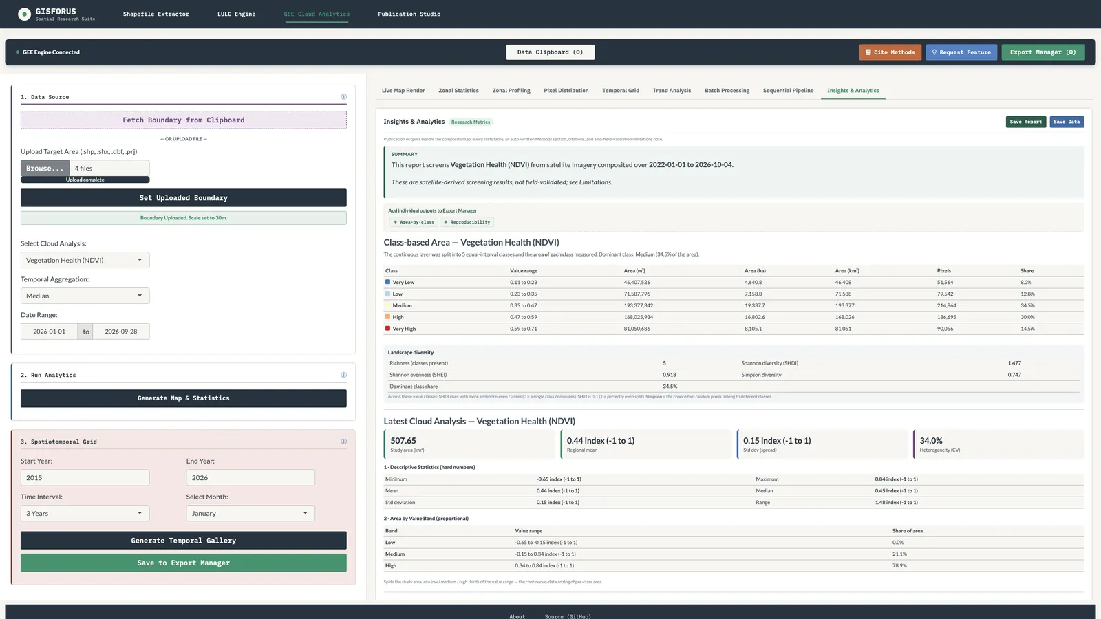
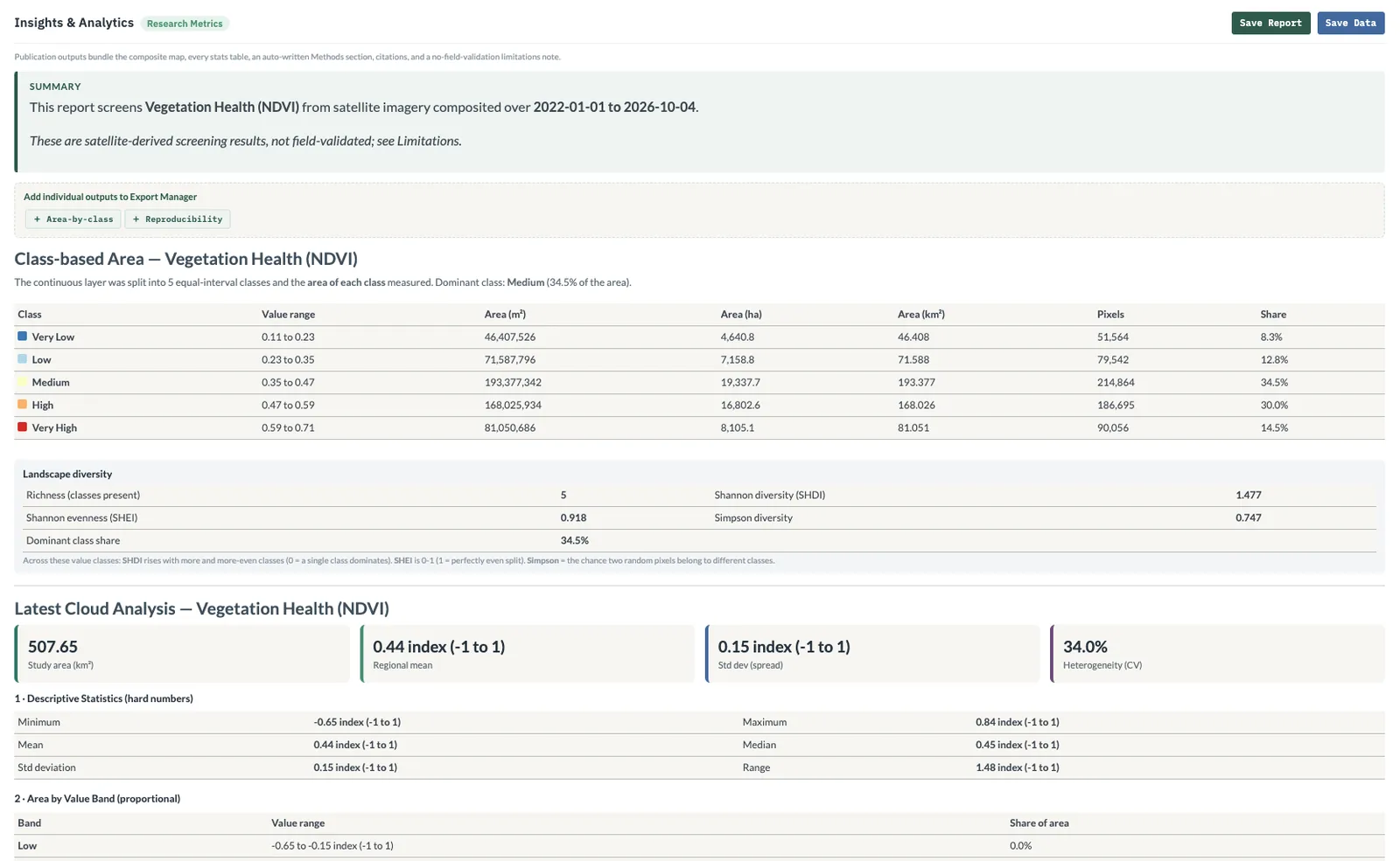
Summary, layer gallery, area by class, landscape metrics, sensors and datasets, reproducibility table, auto-written methods, references and honest limitations. See a sample.
No code, no setup
Pick a boundary, choose what you want, press one button. R and Python are bundled, plain-English insights explain every result, and settings are remembered.
Land cover you can defend
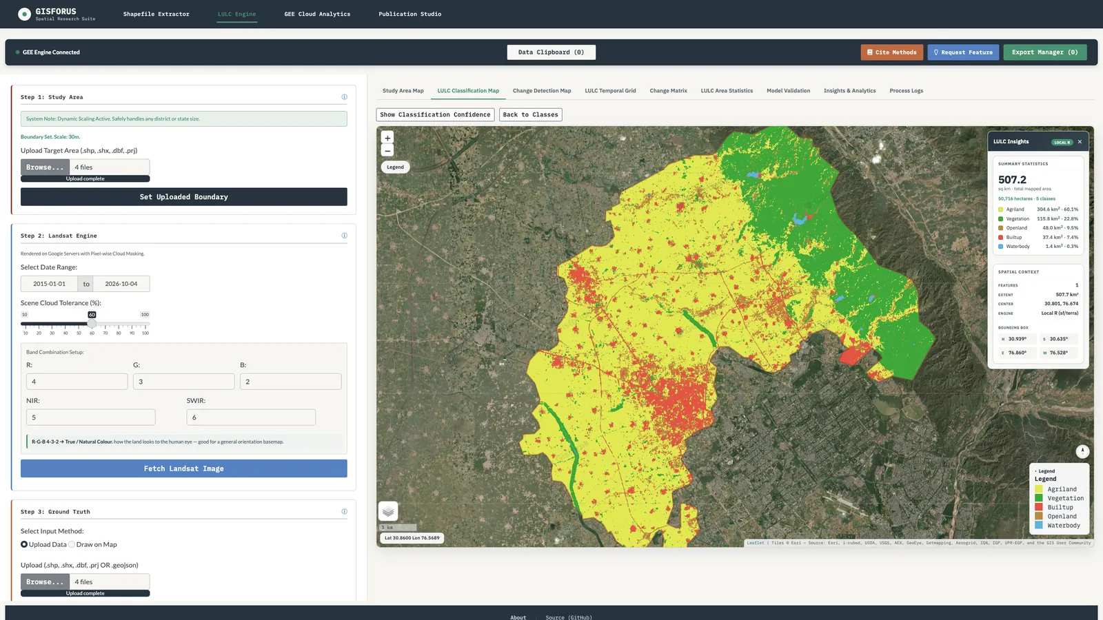
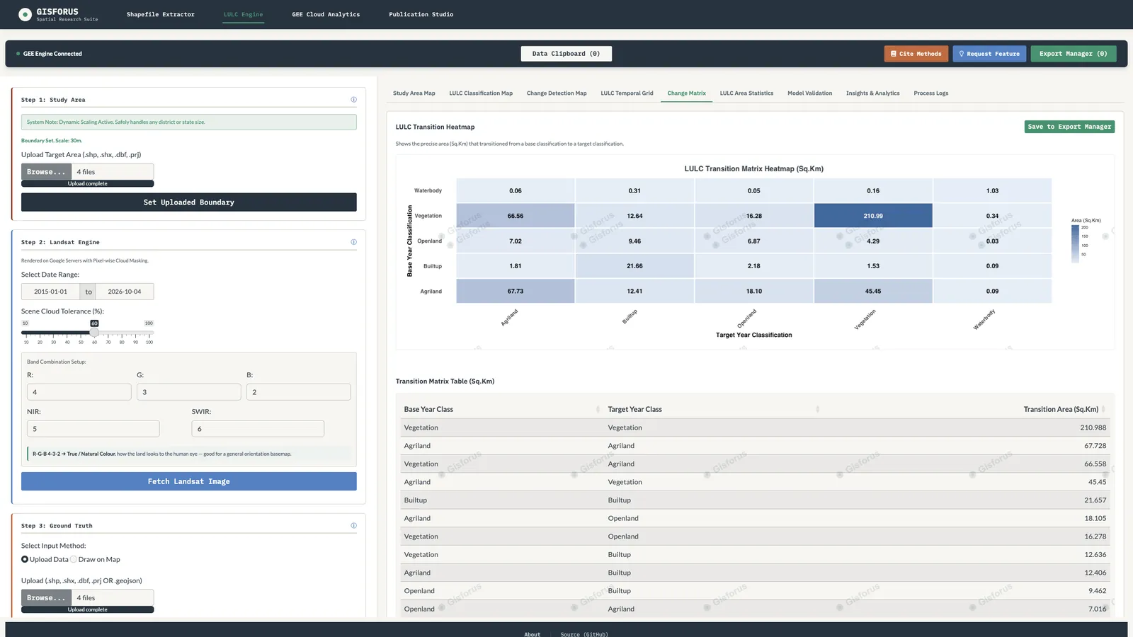
Random Forest, CART or SVM on your own samples, with confidence maps, held-out accuracy, error-adjusted area and multi-year transition matrices.
41 cloud layers, land and sea
25+ spectral indices, terrain, climate, air quality, night lights, plus a coral and coastal module, with zonal statistics and Mann-Kendall / Theil-Sen trends.
Publication Studio
Drop maps and charts onto a print layout with grid, scale bar, north arrow and legend, then export at about 380 DPI.
Sequential Pipeline · Reports
Steps in, report out.
Pick tools from the catalog, set one date range and press Run Sequence. Every run ends with a report: summary, layers, area by class, landscape metrics, datasets, reproducibility, methods and references.
Plans
Analyse everything free. Subscribe to take results out.
Every analysis, map and on-screen result is free, and so is exporting a map image with its boundary. Basic adds data exports and reports; Pro adds the full PDF summary and the workspace bundle.
Subscribe inside the app
Subscribe inside the app
| Free · ₹0 | Basic · ₹299/mo | Pro · ₹799/mo | |
|---|---|---|---|
| All analysis (NDVI, LST, trends, LULC, batch) | ✓ | ✓ | ✓ |
| Interactive maps and on-screen results | ✓ | ✓ | ✓ |
| Export: map image + boundary | ✓ | ✓ | ✓ |
| Export data: CSV / Excel / GeoJSON | — | ✓ | ✓ |
| Individual analysis and LULC reports | — | ✓ | ✓ |
| Full PDF summary report | — | — | ✓ |
| All-in-one workspace bundle (ZIP) | — | — | ✓ |
| Account | None needed | Email, to activate | Email, to activate |
Subscribe from the in-app Upgrade button, which opens a secure Razorpay checkout in your browser. Prices in INR, billed monthly. International cards are accepted and charged in INR at the current exchange rate. Cancel any time by emailing anant4infinity@gmail.com: we stop the next renewal and your plan stays active until the end of the paid period. First-time subscribers can ask for a full refund within 7 days. Your local data and settings are never affected. See the billing terms.
Requirements
What you need before you start.
What's new
Release notes
Release notes for every version are published on GitHub Releases.
Cite the software
Used it in a paper? Cite it.
The concept DOI always resolves to the latest version. The source in the GitHub repository is MIT-licensed (the open research build); the packaged GISFORUS desktop app is a proprietary product, and its paid-export features are not part of the MIT grant. Full metadata is in CITATION.cff in the repository.
Pathak, A. K. (2026). GISFORUS Spatial Research
Suite: Geospatial & Remote-Sensing Analysis
Pipeline [Computer software]. Zenodo.
https://doi.org/10.5281/zenodo.22075123
FAQ
Windows app questions.
Is Spatial Research Suite free?
It is free to download and use: every analysis runs free on your own Earth Engine, with no account needed. Exporting a map image with its boundary is free too. Basic (₹299/month) adds CSV, Excel and GeoJSON data exports and reports; Pro (₹799/month) adds the full PDF summary report and the all-in-one workspace bundle. Earth Engine itself is provided by Google under its own terms.
Is it safe to click Run anyway?
SmartScreen warns because the installer isn't code-signed yet, not because of anything found in it. Download only from this page or our GitHub Releases, and compare the SHA-256 checksum before running it.
Why does Windows ask about the firewall?
The app runs its R analysis engine as a server that listens only on 127.0.0.1, so nothing is exposed to your network. Windows asks before any program listens for connections. Allow or Cancel both work; it is a one-time prompt.
How do I connect Earth Engine?
On first launch the app opens your browser to sign in with the Google account that owns your Earth Engine project, then asks for your project ID (it looks like ee-yourname). You do this once. Credentials stay on your PC; the app never sends them to GISFORUS.
What does the app connect to?
Your own Google Earth Engine account, for analysis and sign-in. The computation engine is locked to your own computer (localhost), so the packaged app can never route analysis to a GISFORUS server. Our billing endpoint, only to verify a subscription by the email you subscribed with. GitHub, when you check for or install an update from the app menu. geoBoundaries, when you load India state or district boundaries in the Shapefile Extractor. At startup it also loads fonts and a few interface libraries from Google Fonts and Cloudflare's CDN, and a live currency rate for price display; none of these carry your data. If you click Send feedback, your message goes to us through Formspree. The app sends no analytics, usage tracking or crash reports. Payments are processed by Razorpay; see the privacy policy.
Where are my settings stored?
In %APPDATA%\GISFORUS Spatial Research Suite\config.json on your PC, with Earth Engine credentials in your user folder's .config/earthengine. They live outside the app, so updates keep them.
How big is the download and why?
About 944 MB for version 1.1.1. The app bundles its own R runtime and Python environment, so you don't have to install either. Allow about 3 GB of free disk space; 8 GB of RAM is recommended.
How do I subscribe, cancel or get a refund?
Subscribe from the Upgrade button in the app, which opens a secure Razorpay checkout. To cancel, email anant4infinity@gmail.com; we stop the next renewal and your plan stays active until the end of the paid period. First-time subscribers can ask for a full refund within 7 days. See the billing terms.
How do I update?
From version 1.1.1, choose Check for updates in the app menu to download and install new versions without a browser. You can also download the latest installer from this page. Your settings are kept either way.
Also on Mac and Android.
The same suite runs on Apple Silicon Macs, and GISFORUS Field takes indices, boundaries and a GPS camera into the field.